Map Pack: Alps
Map Pack: Alps is the 3rd map pack mod that i have released so far.
WARNING: these maps have insane map sizes, so be sure that you have turned ‘experimentalMapSizes = true’ in the settings file, because otherwise these maps WILL NOT LOAD. even if you do have this turned on, the maps are so large that it might take a looooong time to load. but they WIL load, as long as you don’t click on the screen while loading, and just give it time.
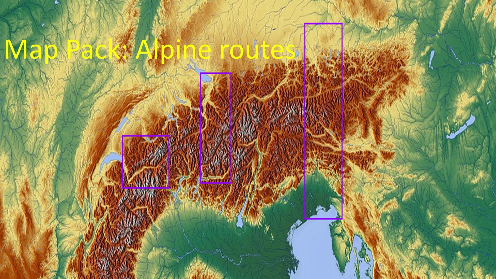
this map pack includes 4 maps: (i kind of forgot about the 4th one when i made the picture)
– Rhatische Bahn Map: a map centered around the area of service for the Graubünden narrow gauge rail network called the "Rhatische bahn". The map ranges from the southern border of Lake Constance/Bodensee in the north, to the Italian valley of Sondrio in the south. Height range: 90-800. Number of Cities: 72. Map size: 2561×7937.
– Wallis Remastered: a map centered around the Swiss province of Wallis. The map ranges from Thun and Interlaken in the north to Zermatt and Domodossola in the south. Height range: 80-700. Number of cities: 106. Map size: 7937×3329. This map is not a original of mine, but as the name suggests, a remaster of a map by someone else: the "Wallis" map by JCRvonRichthofen. a link to his original mod can be found here: https://steamcommunity.com/sharedfiles/filedetails/?id=889703590&searchtext=wallis . So what have i changed form the original? basicly everything. i smoothened out the map, changed the size, added a whole bunch of cities.
– München to Venice (the map i forgot in the picture): a map inspired by the simular scenario in "Railroad Tycoon 3" ranging from München and the south-German lake area, through the Austrian area around Innsbrück and the Brennerpass, to South Tirol (Bolzano, Trente) and in the far south the city-area of Verona and Venice. Height range: 80-800. Number of cities: 182. Map size: 3329×9985.
– Salzburg to Triest: a map centered around the railway connection between the German-Austrian border area around Salzburg, through central Austria around such places like Zell am See, to the north-Italian area around Triest and Udine, as well as the Slovenian border area. WARNING: This map needs the "No initial roads" mod. if you don’t use this mod this map will refuse to load. Height range: 95-800. Number of cities: 119. Map size: 2305×8961.
The area that this map pack focusses on (Alps) is one of the areas in the world that i though to be the most interesting and challenging for this game. The maps however, were an absolute pain to make because towns failed to connect, heights of diffent tiles of the map being wrong, resulting in the horrible process of needing to make little changes to the map, loading it up, finding out it was still f**ck*d up, and needing to change it again. So eventhough i would love to present to you all lots more maps of this area, i will not, at least for now.
so what’s next?
Moar Islands! probebly Greek Agean Islands or the Croatian Adriatic islands will be the focus for the next map pack.
Hope you will enjoy, and see you in my next map pack!
ps: here are some links to other maps of mine:
Map Pack: Ionian Islands Greece: https://steamcommunity.com/sharedfiles/filedetails/?id=1235778909
Map Pack: British Islands: https://steamcommunity.com/sharedfiles/filedetails/?id=1250072475
Harz mountain range 6k map: https://steamcommunity.com/sharedfiles/filedetails/?id=951161950
Netherlands Flanders and the Ruhr area 6k: https://steamcommunity.com/sharedfiles/filedetails/?id=1096442405
dutch map waddeneilanden and friesland 6k: https://steamcommunity.com/sharedfiles/filedetails/?id=948861677

