UK – Penzance to Thurso
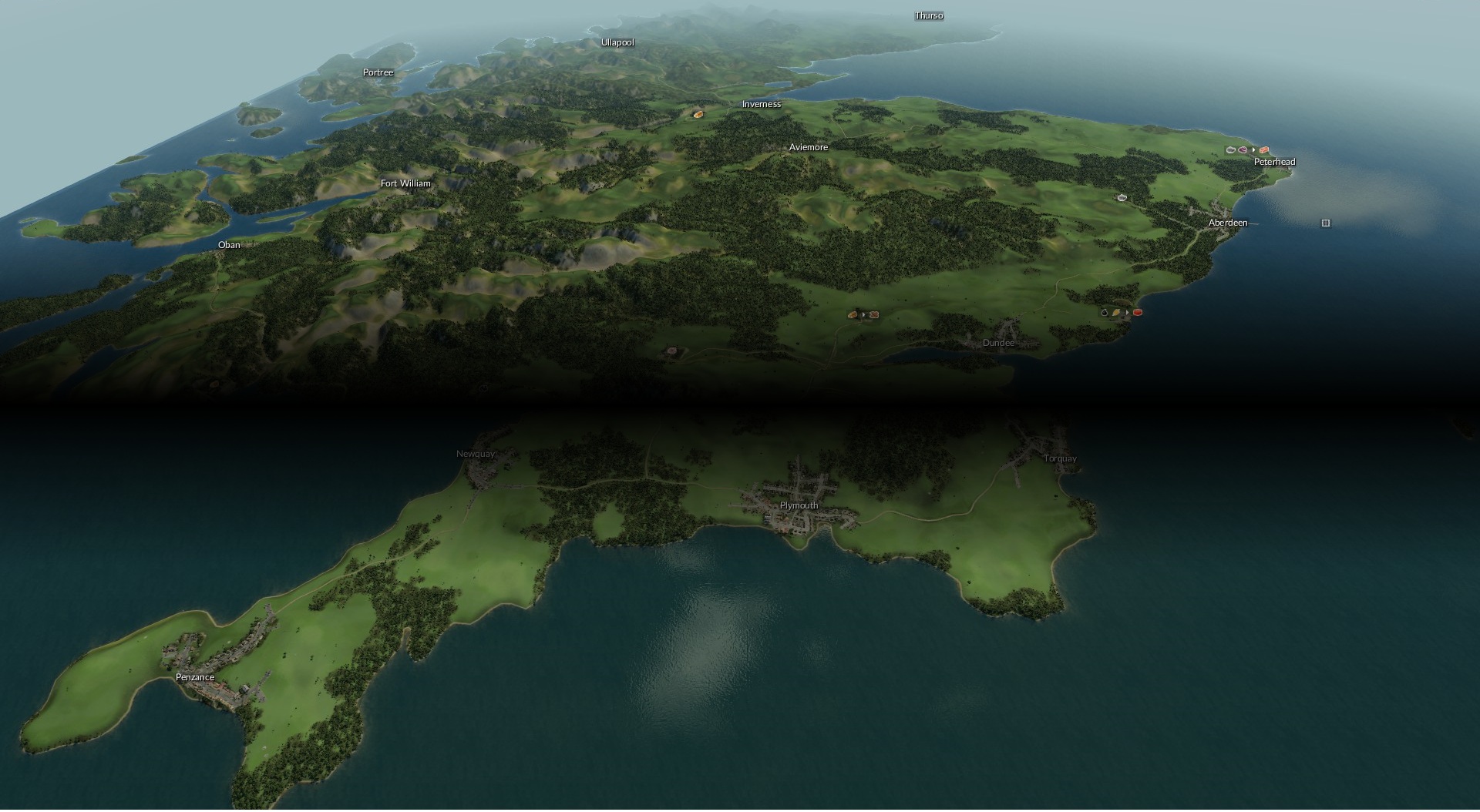
Try to connect Penzance to Thurso by train! This is 1300+ km from "lands end" in the south to the very top of Scotland in the north.
A very large 8193 by 4097 map of the entire UK (except most of Ireland). 80 towns and 83 industries, all manually placed.
NOTE: To play on a map this large, you need to enable a Transport Fever setting. Open the following file in a text editor:
C:Program Files (x86)SteamuserdataSTEAM_USER_ID446800localsettings.lua
Then ensure you have the setting:
experimentalMapSizes = true,
Town centre locations should be reasonably accurate, but due to the street generation may spread into non-realistic areas.
Resources are placed to be roughly in line with resources the real-life uk. e.g. coal, quarries, iron ore in Wales, farms in eastern and southern England, oil in the east midlands, forests in Scotland. Industries likewise with steel, tools around London, Manchester, Sheffield etc.
Runs fine on my dual core 3.2 Ghz pc in 1900, but it will really slow down as cities grow in size. A more powerful PC is recommended.
The screenshots use the "Increased vegetation" mod for more trees.
Customisation tips:
To remove towns/industries (or add more) from the map, find the folder: "uk_penzance_to_thurso" This will be somewhere under "SteamLibrarysteamappsworkshopcontent" and open the "map.lua" file in a text editor.
Then carefully remove lines under the towns and/or industries section. Save the file and start a new free game using this map.
If you want to add towns/industries to get proper location coordinates for you should use this mapping tool from https://www.transportfever.net/filebase/index.php/Entry/2404-TF-Map-Viewer/
Open the "uk_penzance_to_thurso" folder to view the map. The game coordinates of the mouse pointer are displayed in the status bar.

