UN Earth Maps with TSL [RF+GS+NFP+LP]
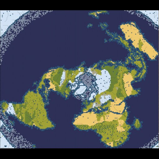
Randomized map scripts of the Earth on the United Nations flag: an Azimuthal Equidistant Projection (AEP) of Earth.

The map is approx. 70% water. It includes a Saharan, Arabian & Australian desert, an Amazonian & Sub-Saharan African rain forest and an inhabitably frozen Antarctica.
(Not World Builder maps, these are true randomised map scripts developed from the land form of a real Earth AEP).
Support for Rise & Fall (reef), Gathering Storm (volcanoes, geothermal fissures, ice melt, coastal flooding and notably river flooding) as well as Standard Rules. New Frontier Pass is supported with Ley Line generation for Secret Societies and true start locations for the new civs and new city states. Leader Pass true start locations.
Maps:
- The Old World (AEP)
- The New World (AEP)
- Oceania (AEP)
- TSL Oceania (AEP) – for Gathering Storm only.
- TSL New World (AEP)
- TSL Old World (AEP)
- United Nations Earth – UNSUPPORTED (due to map size: 198×199).
For an entry level games machine map generation times:
The Old World: <5 mins.
The New World: ~2 mins.
Oceania: ~1 min.
Save game load: ~1 mins.
Currently TSL maps are provided for Oceania (for Gathering Storm rules only), the New World and the Old World. Though UNSUPPORTED it is a check box in Advanced Settings for the United Nations Earth map.
Please post any bugs or errors in the discussions.

