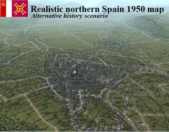
Central Cantabria 1950 – Realistic map
ENGLISH:
Realistic map based on an alternative Cantabria from the late 1940s.
LORE/HISTORICAL BACKGROUND:
The Iberian Peninsula was invaded by the allied forces along with the axis countries and was divided, leaving this sector in the border area of the Soviet side.
There are no signs of destruction on the map, as there were no battles for this territory neither in the Spanish Civil War (1936-1939) nor the Second World War (1939-1945).
The towns near the external borders were evacuated and a double fence was built along the entire border of this republic.
INCLUDES:
Functional road, rail and port infrastructures (1)
About 70 towns with a 100 percent population of about 60,000 inhabitants. (Recommended 50)
Power plant
Textile and chemical industrial complex
Small port
Multitude of details
Delimited border areas
SOURCES:
Topography:
CNIG, 2021 (Spanish National Center for Geographic Information)
Settlements and infrastructures:
First edition of the Spanish National Topographic Map, Sheets 34 and 58, years 1941 and 1934 respectively.
___________________________________
CASTELLANO/ESPAÑOL:
Mapa realista basado en una Cantabria alternativa de finales de los años 1940.
LORE/TRASFONDO HISTÓRICO:
La Península Ibérica fue invadida por las fuerzas aliadas junto a los países del eje y fue repartida, quedando este sector en área fronteriza del bando soviético.
No hay signos de destrucción en el mapa, ya que no hubieron batallas por este territorio ni en la Guerra Civil Española (1936-1939) ni la Segunda Guerra Mundial (1939-1945).
Se evacuaron los pueblos cercanos a las fronteras exteriores y se construyó una doble valla a lo largo de toda la frontera de esta república.
INCLUYE:
Infraestructuras funcionales viarias, ferroviarias y portuarias (1)
Unos 70 pueblos con una población al 100 porciento de unos 60.000 habitantes. (Recomendado 50)
Central eléctrica
Complejo industrial textil y químico
Pequeño puerto
Multitud de detalles
Zonas fronterizas delimitadas
FUENTES:
Topografía:
CNIG, 2021 (Centro Nacional de Información Geográfica)
Asentamientos e infraestructuras:
Primera edición del Mapa Topográfico Nacional, Hojas 34 y 58, años 1941 y 1934 respectivamente.

