Radial Measuring Tool
Feel tired selecting the best location for your next city? Still trying to count what cities are in 6 tiles wonder effect radius?
The best brand new tool for visual city location estimation and various radius related bonuses measurements is here for you only for "Rate Up" the mod!
Works with GS.
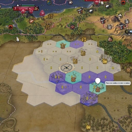
Radial Measuring Tool is a simple tool to visually estimate city location and to measure effect distances. It also shows terrain Yields in not owned tiles in radius and yield/tile count changes between the last and current measured locations. It can also estimate plots and mark the notable locations inside the radius.
New tool button to show/hide RMT dialog is added next to the civilopedia button on top right corner of the screen.
Make a copy of the file UserSettingsEXAMPLE.lua and name the copy UserSettings.lua
Edit the settings in the file UserSettings.lua (read the description in the file).
* This version has no "Ignore map visibility option" and always respects map visibility.
* This version does not show resources that are not revealed on the map due to absence of required technology.
* This version does not use neutral color for map tiles that are not discovered due to visual glitch which reveals the rivers.
Also available on NexusMods [www.nexusmods.com]
Revisions:
Old revisions of this mod are available below. Click the link to download.

